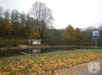

The 1.6 km long walking trail is located in the Gegrėnai Archeological Complex within the Žemaitija National Park, 6 km from Žemaičių Kalvarija town and 14 km from the Žemaitija National Park Administration Plateliai Visitor Centre. The coordinates of the starting point of the trail: 371403, 6219393 (LKS) or 21.933472, 56.091149 (WGS). The trail has way finding signs, and there is a National Park Information Board at the starting point. One section of the trail is of natural paving (1.5 km) and the other part is hard packed soil-paved (0.1 km).
Exclusiveness of Trail Experience: mounds, burial grounds, ancient settlement, landscape.
Brochure and more information can be found HERE.
Zemaitija National Park Directorate
Didžioji str. 10, Plateliai, LT-90420, Plungės dstr., Lithuania
Company code: 191440964
VAT code: LT914409610
The founder is the State Service of Protected Areas under the Ministry of Environment.
Website part-financed by the European Union 2014-2020. Interreg V-A South Baltic Cross Border Cooperation Program.
