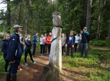

The Paplatelė educational walking trail, 2.3 km long, is located in the Žemaitija National Park on the eastern shore of Lake Plateliai, in the village of Paplatelė, 8.9 km from the Žemaitija National Park Administration Plateliai Visitor Centre. The following are the coordinates of the starting point of the trail: 368287, 6214552 (LKS) or 21.885817, 56.046841 (WGS). The trail has way finding signs, and there is a National Park Information Board at the starting point. The trail is built with several types of paving: natural (0.6 km), hard packed soil (1.3 km) and asphalt (0.4 km).
Exclusiveness of Trail Experience: landscape, sculptures, woodland key habitat, Sultekis pond.
Brochure and more information can be found HERE.
Zemaitija National Park Directorate
Didžioji str. 10, Plateliai, LT-90420, Plungės dstr., Lithuania
Company code: 191440964
VAT code: LT914409610
The founder is the State Service of Protected Areas under the Ministry of Environment.
Website part-financed by the European Union 2014-2020. Interreg V-A South Baltic Cross Border Cooperation Program.
